Mountain Climbing
 Željko Zrnčić
 Svilaja
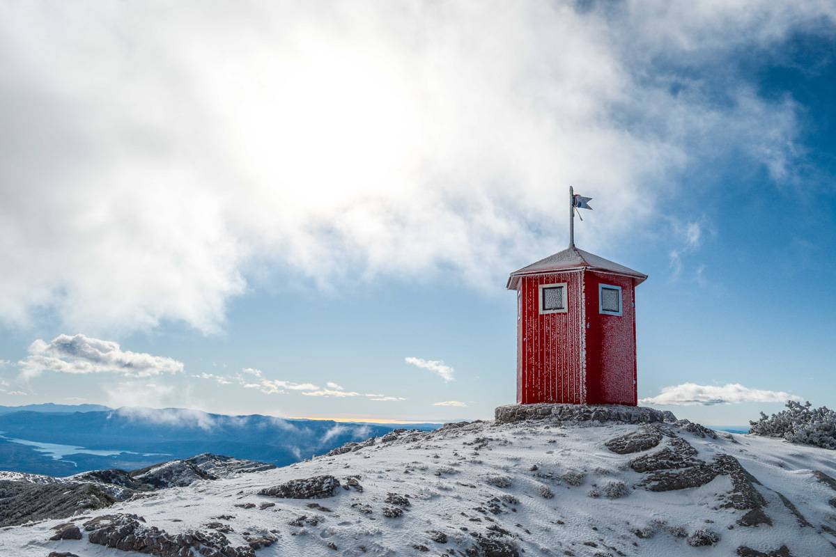
The mountain of Svilaja extends over the area of about 30 kilometres, from Sinjsko Polje Valley to Drniško Polje Valley near the town of Drniš. At an elevation of 1509 metres, the summit of Svilaja dominates this part of the Dalmatian hinterland. The mountain is mostly covered with woods, particularly on its northern side, as well as with grassy pastures and flowery meadows.
″Orlove stine″ climbers’ lodging is located at an elevation of 1065 metres. It can be approached by making a turn in the direction of the village of Zelovo (7 km) off the main road (D1) at Hrvace (8 km from Sinj). From Zelovo, one can carry on the journey driving on an asphalt road for 2 hours and 3 km further on a macadam road (following signposts to Svilaja), or walking on a trail, which will take 45 minutes off the hamlet of Domazeti. The climbers’ lodging is a new building which can accommodate about 50 people. At present it is open by appointment, but the plan has been to bring in weekend duty. On the ground floor there is a 24-hour open climbers’ refuge with 6 beds, a table and a wood-burning stove. Next to the climbers’ lodging there is a drinking water well.
From ″Orlove stine″, there is a trail leading through Badnji, a wooded part, and it takes an hour to pass it. The trail leads from Badnji to a rocky ground (1 h) and the slopes of Vršina, and then further on over the saddle to the very summit of Svilaja (1509 m). There are breathtaking views from the summit on the Peručko Lake reservoir and the mountains – from Sveto brdo, the Velebit summit, through Dinara and its summit of Troglav, Šator and Cincar mountains to Kamešnica in the north and mountains of Biokovo, Mosor, Kozjak and Central Dalmatia islands in the south.
The summit can also be approached by car or walking on the macadam road in the direction of the trail, at the distance of 3 km from the climbers’ lodging. It takes about 1 hour and 15 minutes from there to the very summit. The climb is steep for the first 20 minutes, passing through the beech wood to the saddle of Privija, connecting Crni umac and Vršina peaks. It takes 10 minutes from there to reach the trail leading from Badnji to the summit.
There are also shorter trails in the Svilaja Mountain leading to the craggy area of Orlove stine, Plišivica and Busovača hills.
NOPD Koćari
Glavice 371
21230 Sinj
This email address is being protected from spambots. You need JavaScript enabled to view it.
Dinaric Guides
Ante Romac
This email address is being protected from spambots. You need JavaScript enabled to view it.
Cetina Adventure Klub
Put Župića 39
Sinj
Hrvatska
This email address is being protected from spambots. You need JavaScript enabled to view it.
https://www.visitsinj.hr/en/things-to-do/mountain-climbing#sigProId917b23c576
Visoka
Visoka (892 m) is a mountain rising above Sinj, more precisely, a south-eastern slope of the Svilaja Mountain, the canyon of Sutina dividing them. On the top of Visoka there is a concrete cross over 10 metres in height, a pilgrimage place of the people of the Dicmo village, Sinj and the Cetinska Krajina Region. There is a beautiful view from the top of Visoka: on Sinj, Sinjsko Polje Valley and surrounding mountains from the one side, and from the other side on the valley of Dicmo and further on the sea and islands.
The starting point for Visoka is the village of Radošić (2 km from Sinj), the hamlet of Župići, from which place a trail is followed, next to the water reservoir. A steep climb of Karlova greda follows (35 minutes), after which there is a less steep part leading to the meadows below the top (25 minutes). The final climb to the concrete cross on the top of Visoka takes 5 minutes. From the cross, a karst path is taken westwards, through macchia (dense evergreen underbrush), junipers, gentle karst valleys and scrub woods to Visošnica (2 h). From that place the path runs steeply downhill to the Drniš – Sinj road (5 km to Sinj) in the canyon of Sutina torrent, above the hamlet of Đipalo-Ban (35 minutes).


